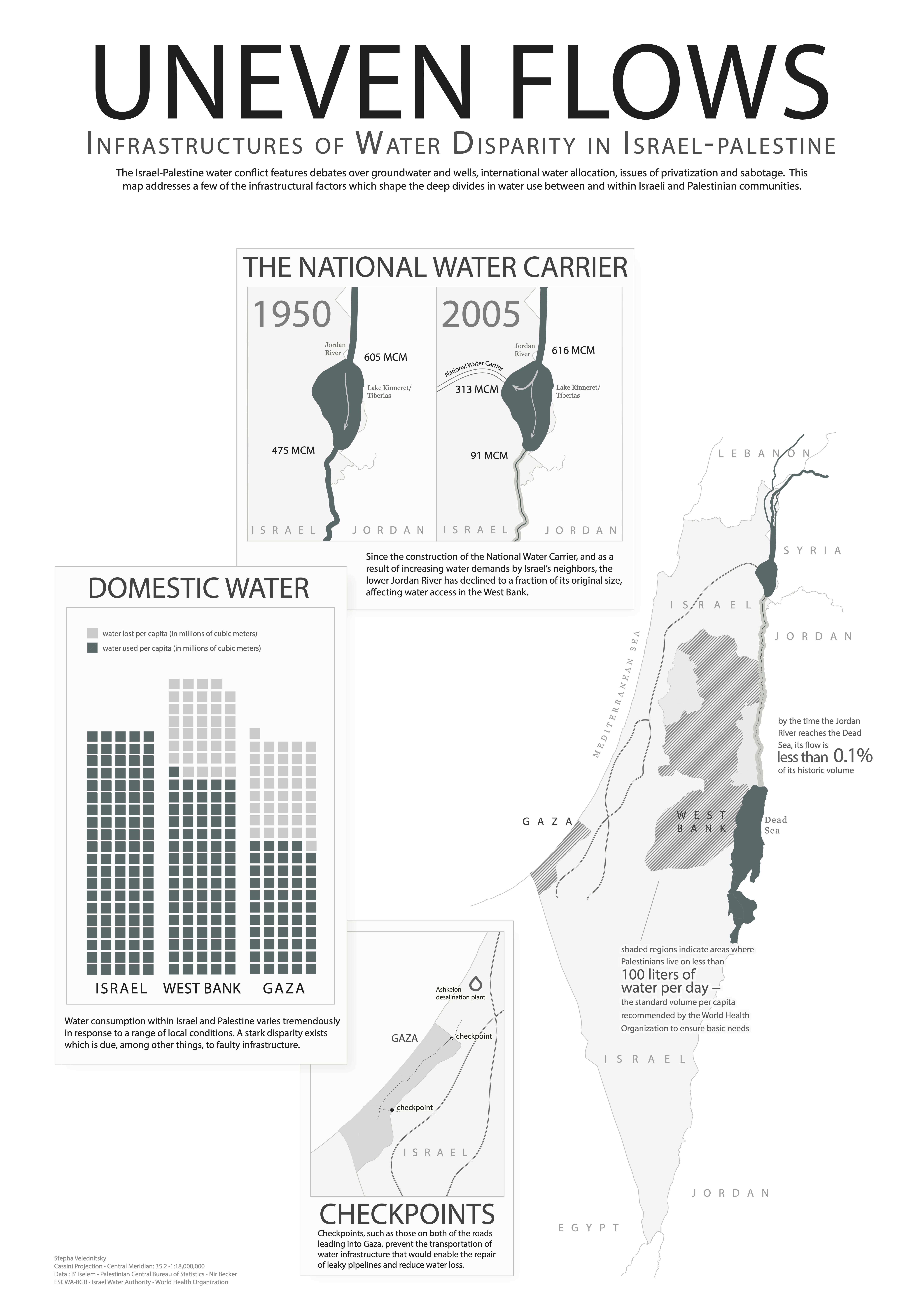
My first major mapping project was an infographic poster. This infographic describes some of the ways in which Israeli infrastructures contribute to water scarcity in Palestinian communities outside of the Green Line. It highlights the role of the Israeli National Water Carrier in diverting water away from West Bank communities bordering the Jordan River, of checkpoints that prevent the transportation of water pipes into Gaza, and the resulting disparities in water access.
